 Processing & Interpretation
|
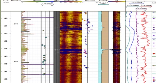
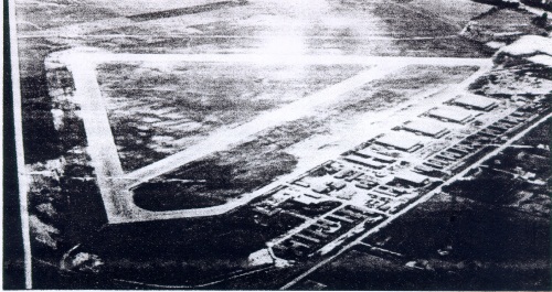
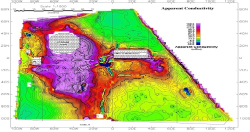
Data analysis and interpretation requires not only a fundamental understanding of the geophysical techniques but also a thorough appreciation of the targets and purpose of the survey. Since the 1970’s WGI and its staff have applied a wide variety of geophysical techniques to site characterization with hydrogeologic, geotechnical or remediation targets.
Below is a table which outlines the technique applicability of WGI's experience with geophysical techniques and targets.
|

|
| Techniques | Targets | |
|---|---|---|
| Surface: | Geologic layering | Infrastructure |
| Seismic Refraction (P&S wave) | Hydrostratigraphy | Tanks |
| Seismic Reflection (P&S wave) | Fractures | UXO (land, underwater) |
| Ground Penetrating Radar | Karst | Groundwater Plumes |
| Resistivity Imaging | Saltwater Intrusion | Wells and casings |
| Terrain Conductivity | Aquifers / Aquitards | Plume monitoring |
| High Resolotion TDEM | Archeological | Drums |
| Magnetics | Fill Thickness | Pipes |
| Gravity | Aggregate | Utilities |
| VLF / VLF-R | Water Depth | Soil Contamination |
| Marine Surveys | Sub bottom | Leachate |
| Borehole: | Engineering Properties | Landfill Limits |
| High Resolution Temperature | Ice Walls | Liner Integrity |
| Gamma | Voids | Tailings |
| Conductivity | Ripability | UXO Target zones |
| Acoustic/Optical Televiewer | Rebar | Foundations |
| Sonic | Clay Content | Forensics |
| Neutron | Buried valleys | Graves |
| Density | Well Construction | Concrete Condition |
| Caliper | Permafrost | Construction Parameters |
| Video | Dam Sites | Septic Systems |
| Cross Hole Applications | Repository Assessment | Site Comparisons |
| Technique Applicability | ||
|---|---|---|
| Consistently | Frequently | Occasionally |
| Hover over techniques or the targets for applicability using the above key | ||

Copyright © 2011
WaterlooGeoPhysics Inc.